

Welcome to the personal website of Andrew Turnbull. This outpost features tons of stupefying and trivial things pertaining to various and diverse interests of mine. Chances are, if there's something I know about or like that doesn't much other representation on the 'net...there's a bit of it here.
January-March 2020 Archive
30 March 2020
![[Thunder Bay mystery sign]](new20/tbay-mystery.jpg)
As I begin my second week of being marooned at home, I feel compelled to ponder the mysteries of the world that surrounds us.
What could possibly be more mysterious than this sign? It's a yellow circle on a square, and it's posted on a road to nowhere on Mission Island in Thunder Bay. I have no idea what it means.
![[Thunder Bay mystery sign]](new20/tbay-mystery2.jpg)
The road ends at a river...and the foot of another sign. It's a red circle on a square. And I have no idea what it means, either. It surely isn't a navigational marker.
Any answers? Or ideas? I'm all ears.
23 March 2020
Crossing the Pigeon River
Thunder Bay and the expanse of Canada that surrounds it is connected to the United States by a bridge and border crossing on the Pigeon River, not far from Grand Portage, Minnesota.
That wasn't always the case. At the dawn of the twentieth century, Port Arthur and Fort William were effectively an island in the wilderness connected to the outside world by rail and ferry only. There were roads that snaked around, but they were primative...and they didn't lead anywhere.
A road from Fort William to the Pigeon River was completed in 1916. But, there was no funding for a bridge crossing the river. So, what happened? The Fort William-Port Arthur Rotary Club elected to take matters into its own hands, solicited donations in conjuction with their compatriots in Duluth, and built a bridge themselves...without official governmental approval! The so-called "Outlaw Bridge" was a rickety span of timber that cost $4801 to build, and it formally opened to traffic on 18 August 1917. As befitting its "Outlaw" name, the bridge didn't initially have any customs offices or border controls; though that state of affairs didn't last long.
The Outlaw Bridge was eventually "officialized." The south approach became part of U.S. highway 61 in 1927; the north approach became part of Ontario highway 61 ten years later. By that point, however, the original bridge was gone: In 1934 it was demolished, and replaced by a steel truss on the same site.
In 1964 the third Pigeon River bridge opened, a simple girder affair located nine kilometres downstream. This bridge still exists today, and it's so boring that you barely know you're on it when you cross the border.
![[Old Pigeon River international crossing]](new20/pigeonriver-1.jpg)
But what happened to the old bridges, and the old border crossing? The old stub of Highway 61 that approaches it is still traversable, although the pavement is rough. Part of it is now signed as secondary highway 593, and part of it is signed, prosaically, as "Old Border Road."
![[Old Pigeon River international crossing]](new20/pigeonriver-3.jpg)
The bridge is gone. The road ends in a cul-de-sac, with a striped guardrail blocking the chasm. A similar scene exists through a gap in the trees on the other side.
![[Old Pigeon River international crossing]](new20/pigeonriver-2.jpg)
Looking east, one gets a sense of the elevated scale of the surroundings. The left side of the river is Ontario; the right side is Minnesota. The left side is Canada; the right side is the United States. The left is the land of the free, the right is...well, you get my drift.
And yes: The river's frozen. You could simply walk across it if you thought you could get away with it. (Though considering the US, they'd probably have ICE goons in mukluks prowling the woods.)
![[Old Pigeon River international crossing]](new20/pigeonriver-4.jpg)
Looking down, we see the edge of a bridge abutment...the only visible concrete evidence (see what I did there?) that this deserted scene was ever a major transportation link.
![[Old Pigeon River international crossing]](new20/pigeonriver-5.jpg)
Looking back, we see the road leading away. Until 1964, this scene was the southern terminus of Ontario highway 61. I believe that the customs house would have stood on the left side, just fore of the trees. There is nothing left of it, nor of the gift shops and visitor attractions that were once clustered on the other side.
All for now.
16 March 2020
My flat licence plate essay got some attention on Toronto Reddit the other day. Wonder how many folks bothered clicking through to the front page to read my thoughts on Mr. Ford's marvellous new design? (Probably none!)
![[Ontario licence plates on a wall]](new20/ont-platewall.jpg)
Since everyone's sequestering themselves indoors this week, enjoy this outdoor picture of the Province of Ontario's previous pieces of stamped steel. This is on the wall of an antiques store between London and Stratford that I never did go inside, because I never could figure out when it was supposed to be open.
9 March 2020
Was ist das? Die Berliner Mauer?
![[The Thunder Bay Wall]](new20/tbay-wall.jpg)
I don't yet know the story, but it's in Thunder Bay, Ontario.
2 March 2020
A Proposal for a New Ontario Licence Plate Design
Backing up to February, it's clear that Ontario's new licence plate design doesn't have a lot of good qualities going for it. So what would be better?
Let's start by deconstructing plates to their core. Their first and foremost role is to identify vehicles. Clearly. Effectively. Anything else is pure window dressing.
For sixty-odd years, nigh every licence plate on the North American content has been a scant six-by-twelve inch rectangle...15 by 30 centimetres, in contemporary units. This was an arbitrary size, selected in the mid-1950s to placate Detroit's automotive stylists. I'm more a fan of the Australian standard of 13 by 37 centimetres, which allows for wider and much more legible characters while also cutting down the amount of "dead space" along the top and bottom edges. Unfortunately, a 13x37 cm standard is physically incompatible with the plate recesses on some Canadian-spec vehicles. That shouldn't stop us: A 15x30 cm plate can still be legible, we just have to be skilful in order to use the limited size effectively.
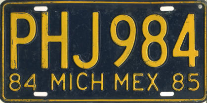
Being skilful with a 30 cm plate length means restricting ourselves to a serial length of six figures. (Five would be better still, but five figures don't offer enough capacity for a place where 12.5 million vehicles are registered.) This means discarding Ontario's absurd ABCD-123 format, and also discarding the illegibly slender dies it requires. Let's go back to the bolder, wider, and more gracefully curved serial dies that Ontario used from 1967 to 1994...or possibly something even wider than that, like the squat dies on this Mexican plate.
The six-figure ABC-123 format hasn't been issued in Ontario since 1986. The reverse 123-ABC format has barely been used since 1997. Why not reuse some of these legible and desirable serial combinations? The MTO is well past overdue to apply a sensible retention schedule to its annals of motor vehicle records, purge its database of licence plates that expired 20, 30, or 38 years ago, and allow this to happen. Alternatively, why not follow the lead of Quebec or the Netherlands and use four letters and two numbers? Formats like ABC-12D, A12-BCD, and AB-12-CD each offer up to 45.7 million unique combinations apiece, without any need to delve into seven figures.
The biggest stink about the new plates comes over the change in slogan: The celebratory Yours to Discover sentiment of the previous 38 years is out, replaced by the vague A Place to Grow, the obnoxious Open for Business, or their equivalents en Français. But is a slogan even necessary at all? Short answer: It isn't.
A 1960 University of Illinois study found that slogans reduce the legibility of other elements on plates, and proposed eliminating them entirely. No slogan would also obviate the need for Ontario to produce and inventorize separate stocks of plates in English and French. So let's scrap the slogans, shift the serial down, and plaster "Ontario" across the top in letters as big and legible as will fit. In mixed case, too (à la Quebec), for improved readability at a distance.
Ontario's new plates are white and blue. So were the old ones. All Ontario passenger plates have been blue and white for the last 55 years, and you might be forgiven for thinking that blue and white are the province's official colours. But they're not: Green and gold are. Green and gold also don't allow for an awful lot of contrast, and have rarely been used on licence plates. Our solution? Side-step the PC party colours and the official colours, and instead go back to the badass black-and-white of the late 1950s. Another bonus? Maximum contrast!
It goes without saying that the plates should be embossed, to ensure that they retain a modicum of legibility even when kissed by snow, dirt, or the glare of the evening sun. They should also be distinctive, and durable: After all, some Ontario licence plates have been on the road for 47 years and counting. Long-term durability means rethinking the norms of manufacturing materials, though: Woe be the provincial purveyor of plates when the 3M reflective sheeting on those plates starts to peel and shred after 7 of those 47 years.
There's a solution to this problem so obvious that it exasperates me that no state or province is currently exercising it: Dump the reflective sheeting entirely, and instead start manufacturing plates with glass bead reflectorization on the raised surfaces. Such plates are immune to blistering, peeling, and shredding...and though they lose a modicum of reflectivity over decades of extended use, they maintain readability during the day and age far more gracefully than plates with reflective sheeting do. To be legible, this technique obligates the use of light numbers on dark backgrounds, the reverse of most plates in use today...which means that any plates produced with glass beads stand out boldly from the pack.
Ontario actually pioneered this manufacturing technique on doctors' plates in 1939, yet never used it again. Beaded plates enjoyed extended periods of popularity in 17 U.S. states and Alberta due to their lower cost, and were the general issue in Michigan as recently as 2006. Maybe someone at Trilcor could call the prison in Adrian, Michigan, and ask them if they have some surplus bead-applying equipment that they could send over the border? It'd be worth a shot.
Painted borders are elements that clutter designs, and it's an embarrassment that the reflective white edge on the new Ontario plate design is more visible at night than the serial is. So, our proposal won't have one. We'll indulge ourselves in allowing one superfluous element on the plate, just to add visual interest: A graphical separator embossed between the letters and numbers of the serial. It could be a trillium; it could be a crown. (The former is preferable, since the monarchy is a superfluous ceremonial institution whose end is probably coming sooner rather than later.) But it should not be both.
One last touch: The validation sticker. The current version isn't exactly a bastion of legibility, with its tiny year digits and crammed-together three-letter abbreviations. Nor do the colours really work: Ontario cycles through a different colour every three months, and thanks to early renewals and two-year registrations there are as many as fourteen colour schemes that may be valid at the same time!
So, let's get to work: Like the province name, the validation sticker should be made as big and as bold as possibly will fit on the plate. Let's make it 50% bigger. Let's move the serial to the edge, where it doesn't get in the way, and set the expiration date in numerals that can be read at a car's length or more. Let's use numeric months, both for legibility (a numeric "1" can be printed larger and more boldly than a three-letter "JAN") and to obviate the language issue. With a legible month digit to establish validity, the province would be free to change the colour scheme every twelve months instead of every three, thus linking it to the expiration year and reducing the number of potentially-valid colour schemes from an unmanageable fourteen to a manageable four.
Add all of this up, and what do you get? You get this:
![[Andrew's Ontario licence plate proposal]](new20/ont-plate-proposal.png)
I can dream.
24 February 2020
About those new Ontario plates...
![[Ontario's terrible new licence plate design]](new20/ont-newplate.jpg)
It's a tragedy, really.
Ontario's licence* plate collectors have been starved of excitement for decades, with little to keep themselves occupied other than watching the letters tick by. Any opportunity for a new design...particularly a new general-issue design available to all...ought to have been a cause for celebration.
But celebrating is the last thing I want to do, given the design and the circumstances of how it came to be.
Where to begin? Well, much like the current round of teachers' strikes, the new Ontario licence plate design is the crackhead's brother's legacy. It's his way of leaving a visible mark on the province, in much the same way that a dog visibly pisses on its territory. That alone is enough to leave a stench.
Licence plates should not be flat. The new plate is flat. Completely flat, with not even a raised edge to lend stiffness to the material. Which means that not only will the plates flap, vibrate, and get reduced to crumpled balls of tinfoil after a few bumper lashings, but they're also illegible when they're covered in salt, silt, or snow. Which in Ontario, means that they're going to be illegible for half the year.
The flat plates were produced with 3M's Digital License Plate system, using the same Minnesota-lookalike serial font that nigh every 3M plate uses. Which tells me that 3M executives probably mailed a pretty big cheque to Doug Ford's headquarters. 3M executives helped bankroll Tom Emmer's far-right Minnesota gubernatorial campaign in 2010, and they'd surely pull the same stunt north of the border if they could.
![[Ontario's terrible new licence plate design]](new20/ont-newplate2.jpg)
The first new-style Ontario plate I attempted to photograph.
Remember what I said about them being illegible for half the year?
Let's nitpick the design. Licence plates should be legible, and the most legible part of any design (after the serial itself) ought to be the state or province name. Yet, the name on the new Ontario plates is absurdly tiny. Tinier than it is on the outgoing embossed plates, which don't exactly have bold printing for "Ontario" as it is. The seven-letter O-word looks practically lost and alone on the plate; a blurb of fine print surrounded by a sea of blue. Woe be you if you're a minority, and the target of an overzealous cop with an axe to grind because he can't tell where your vehicle's from.
The old design had a crown on it. The new design has a crown and a trillium, adding a dose of clutter. Why both? Why not one or the other? Evidently, "Keep It Simple, Stupid" isn't a tip that Doug Ford wants to hear.
Oh, and then there's the sorest point of the design: The slogan. "Yours to Discover" isn't crass enough a sentiment to placate the Conservatives, so those words are gone from commercial truck plates, replaced by "Open for Business"...an obnoxious spiel of corporate plunder that is West Virginia's way of haunting me for the rest of my life. Car plates bear the words "A Place to Grow," which sounds innocuous until you remember that the sentiment is being filtered through PC code. A place to grow...what? "A Place to Grow Carbon Emissions," probably. "A Place to Grow Public-Sector Unemployment Ranks." Or, "A Place to Grow Doug's Pocketbook." Fuck that.
The new colour scheme is a reversal of the old one. Not coincidentally, the new colour scheme also happen to be the Progressive Conservative party colours. If the nakedly partisan posturing wasn't obvious enough, Ford's minions have taken to calling the outgoing, better design the "Liberal Plate," which is not only loathesome but completely false. (The previous design was introduced by Bob Rae's NDP government, as a subtle modernization of a design originating during the PC government of Bill Davis. But I don't expect facts to matter to these guys.)
![[Ontario's terrible new licence plate design]](new20/ont-qtips.jpg)
I regret to say that I'm not the first one to make this design comparison...
In the background is...a swath of another shade of blue that looks like a completely random piece of clip art. It took me days of head scratching before I realized that this detail was actually Ontario's trillium logo, zoomed in to look meaningless. Other than making it not look like an Indiana plate...why?
Oh, and another thing: There are two ways to print flat plates with light characters on a dark background. The right way is to print the serial and dark background in one swoop, letting the light-coloured reflective sheeting be exposed through the unprinted portions where the letters and numbers are. The wrong way is to print the dark background atop the sheeting in one pass, then use a second pass of non-reflective white or light ink to print the serial atop of that. You can guess which way Ontario and 3M did it.
So there you have it: Ontario's new licence plate design. A positive opportunity completely ruined by atrocious motivation and execution. And a reason why my interest and enthusiasm towards the licence plate hobby is a fraction of what it was ten or even two years ago.
*After years of deliberation, I've come to the conclusion that "licence plate" with a C is the more correct spelling in Canadian English. Nigh everything I've written about licence plates in the past uses the "license plate" spelling with an S, so it's doubtful that this is one rule I'll ever achieve full consistency about!
17 February 2020
![[GO Transit coach in Thunder Bay, Ontario]](new20/gotransitcar.jpg)
There is no passenger rail transportation in Thunder Bay, Ontario. There hasn't been any since January 1990, when the Mulroney government took a machete to most of VIA Rail's routes on CP lines. In spite of mumblings about changing that, nothing about the situation has changed in the intervening 30 years. The Lakehead has been left high, dry, and isolated to anyone without a car.
Meanwhile, rail passenger coaches for GO Transit in the Toronto area are built by Bombardier in Thunder Bay.
Which means that in Thunder Bay, you're subjected to the constant tease of trains pulling passenger cars. Cars you can't board. On trains you can't board. Going places you can't go.
10 February 2020
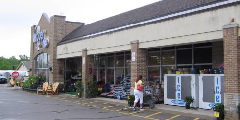
I wrote a thing!
![[Safeway in Thunder Bay]](artifacts/safeway-tbay.png)
The First 90 Years
Enjoy.
3 February 2020
![[11'2 and 3.3m clearance signs]](new20/sign-clearance.jpg)
I harbour no love for archaic 18th-century units of measure...but I'm always interested in artifacts and holdovers in signage, and this includes reminders of Canada's pre-metric past.
Here, a modern metric clearance sign is posted astride an old painted designation in feet and inches. 11'2" works out to 3.4m, not 3.3, so the clearance has evidently been reduced due to road paving over the last 42 years!
"132.80" is a marker for the Canadian Pacific railway, and I honestly have no idea whether they ever converted to kilometres or not.
27 January 2020
![[Ontario Highway 802 marker]](new20/on-802.jpg)
Here's something you don't see every day: An Ontario tertiary provincial highway! These are gravel-surfaced roads, denoted by tiny, unadorned markers with high numbers in the 800 range.
Tertiary highways connect locales such as lumber camps and ghost towns to main thoroughfares...and they have never been common. In southern Ontario any road of minor stature would fall under county or city control...so tertiary highways only exist in the northern reaches of the province. Tertiary highways cease to be tertiary when they've undergone paving, striping, or other improvements. Factor in Mike Harris' 1997 gutting and filleting of the provincial highway system on top of that, and you have a real unicorn on your hands! Only five tertiary roads currently exist...and all are tricky and time-consuming to get to, unless you live in Thunder Bay.
![[Ontario Highway 586 marker]](new20/on-586.jpg)
Ontario's secondary highway classification is also pretty well exclusive to northern Ontario these days, though that hasn't always been the case. These are marked by flowerpot signs similar to those used for southern Ontario county highways, but with the shape reversed.
Highway 586 is a 5-km spur that extends along the shore of Lake Shebandowan...which is also where the historic Dawson Road from Port Arthur terminated in the nineteenth century. And yes, I followed it to its end in the January snow. Those who know me would expect no less.
13 January 2020
Minnesota Supermartifacts
It's difficult for me to write about anything as the world figuratively and literally burns...even the geeky stuff that I like to write in the best of times. Nevertheless, I try...
![[National store]](artifacts/nat-mnduluth19.jpg)
2224 W. Superior St., Duluth, MN
What geeky stuff do I have today? Just a continuation of the Minnesota tangent that I'm on, crossed with my determination to deconstruct the history of supermarkets and the cities they served.
Loblaws' defunct stateside subsidiary National Tea used to operate stores in Minnesota...just like in Michigan and Wisconsin. The cities of Minnesota are littered with repurposed National buildings...just like in Michigan and Wisconsin. Unlike in Michigan or Wisconsin, however, National's Minnesota division managed to last until the 1980s and this store could have housed its original occupant as little as...well, thirty-seven years ago. (Damn, where has the time flown?)
![[National store]](artifacts/nat-mnduluth19b.jpg)
15 S. 13th Ave. E., Duluth, MN
Yet another old supermarket building in Duluth. Like the last, I managed to confirm this one as a former National location. Unlike the last, it's still selling groceries under auspices of Super One Foods, a local chain. And also unlike the last, this one is housed on the upper floor of an absolutely bizarre two-story building with buttresses and windows running down the side! Have I ever seen anything like this before? I think not...
![[Kroger store]](artifacts/kro-mnminneapolis19.jpg)
4626 Nicollet Ave., Minneapolis, MN
The Kroger Company of Ohio once had stores in Minneapolis, Minnesota. "What?!", you say. "That's preposterous!"
But it's true. Between 1960 and 1970, four Kroger stores opened their doors in the city of Minneapolis. All four had closed by 1975, as the company cut its losses and bailed from the area. Yet, two of the buildings still stand: This one on Nicollet straddling the King Field and Tangletown neighbourhoods, and an identical store on 3010 Penn Avenue. Both buildings feature a three-tier window arrangement and fieldstone wall accents, and would have looked identical to this Kroger in Grosse Isle Township, Michigan at one time. This fact is extremely interesting to...well, probably one other person.
All for now...
6 January 2020
![[Minnesota welcome sign just aft of the Canadian border]](new20/minnesota.jpg)
Road Signs of Minnesota
Well! Shall we begin our tour? Of course...
![[Minnesota road sign]](new20/mn-71-28.jpg)
We'll begin with the route marker signs. US highways are signed pretty much the same in Minnesota as they are anywhere else, but state highways are not. Minnesota's state route marker design is unusually ornate and colourful, and you won't get any complaints about it out of me! Except for one thing: At a distance, it looks like an Interstate shield. Blue signs are crapshoots for road class in Minnesota.
![[Minnesota road sign]](new20/mn-i35.jpg)
And speaking of Interstate shields, here's a specimen that happens to have the state name emblazoned on it! This is unusual for Minnesota, where most shields bear the route number, the Interstate legend, and nothing more.
I strongly suspect this is less a case of being an older sign, and more a case of a county- or township-level sign shop inadvertently fabricating a new sign from an obsolete template. I've tacked over and around the course of I-35 between Grand Portage and the Twin Cities in both directions...and the only "state name" Interstate shields appeared off the highway, which lends corroboration to the latter scenario. The peculiar arrow placement is probably also the fault of a county- or township-level authority.
![[Minnesota road sign]](new20/mn-old61.jpg)
The most lore- and fame-ridden highway in Minnesota might be U.S. 61, immortalized by Duluth native Bob Dylan in Highway 61 Revisited in 1965. Over half the highway's length was also decommissioned or downloaded in 1990, due to I-35 making it redundant. In some segments between Duluth and the Twin Cities, the old course of the road has been signed with these interesting pseudo-historical cutout "Old Hwy US 61" markers; though I can testify through experience that the quality of signage isn't good enough to prevent a traveller from getting lost trying to follow them!
This photo also shows one of the methods in which county highways are signed in Minnesota. There isn't a lot of consistency here.
![[Minnesota road sign]](new20/mn-hennepincounty.jpg)
Yes, there isn't a lot of consistency in signing county highways in Minnesota. Some counties prefer white squares, others blue pentagons, others both.
The idea of numbered county highways is a bit novel in itself in the eastern half of Hennepin County, which basically consists of urban Minneapolis city streets. At least Hennepin actually uses numerals in the proper, regulatory yellow colour: A fair number of counties are lazy, and just stick white numerals intended for Minnesota state or Interstate route markers onto the blue pentagon-shaped blanks.
![[Minnesota road sign]](new20/mn-35e-35w.jpg)
Minnesota is one of the rare places where an Interstate highway takes on a split with letter suffixes. Such splits were actually fairly common in the Interstate System's earliest days, but most were eliminated by renumberings by the 1980s. This couldn't have worked in the Twin Cities, though: I-35E serves St. Paul, I-35W serves Minneapolis, and to "demote" one segment to another number would have meant demoting one Twin City in favour of the other! And that would never fly in Minnesota.
![[Minnesota road sign]](new20/mn-pedxings.jpg)
Let's get away from route markers for a bit. This Pedestrian Crossing sign in downtown Minneapolis is obviously on the old side, because it's a) cracked and discoloured, and b) plain yellow instead of fluorescent yellow-green. What caught my eye, though, was the supplementary plaque reading "Ped Xings," in the plural. Was this an old Minnesota standard, or just a one-off deviation cooked up for this installation? I wish I knew the answer.
![[Minnesota road sign]](new20/mn-noturn.jpg)
And speaking of old Minnesota standards, downtown Minneapolis is the only place I ever recall seeing "No Turn On Red" signs with a red ball in the middle! A bit disorienting to read from top to bottom, but I like it.
There's nothing unusual at all about the "One Way" sign, or the crossing signal with built-in countdown. And that concludes our tour this week...
![[Back]](back.gif) Newer posts
Newer posts![[Forward]](forward.gif) Older posts
Older posts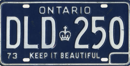